"03fb4cdb4570dd17"{"id":"22944","slug":"world-map-globe-edition-2","title":"World Map Globe Edition 2","category":"GUI","engine":"Original Unity version: 2022.3.24","assetVersion":"Original Unity version: 2022.3.24","engineVersion":"Asset Version:19.2","tag":"GUI","accent":"cyan","visual":"animation","summary":"World Map Globe Edition 2 provides a comprehensive 3D globe prefab for Unity, featuring offline data for thousands of cities and provinces alongside advanced shader support for mobile and desktop projects.","platform":"Unity","publishedAt":"2026-04-07T13:28:13.000Z","updatedAt":"2026-04-19T15:36:56.000Z","sourceNotes":[],"fileContents":[],"compatibility":["Unity","Original Unity version: 2022.3.24","Asset Version: 19.2"],"featuredImage":{"alt":"World Map Globe Edition 2","src":"https://3dcghub.com/wp-content/uploads/2026/04/6b53752f9192_8e043e1b-3e60-4ebe-98cd-548cfb1fb6f2_1280x720_stretch.webp"},"hasDownloadLink":true,"downloads":0,"terms":[{"taxonomy":"category","slug":"gui-tools-unity-2","name":"GUI"},{"taxonomy":"post_tag","slug":"plugins","name":"Plugins"},{"taxonomy":"post_tag","slug":"tools","name":"Tools"},{"taxonomy":"post_tag","slug":"unity","name":"Unity"}],"galleryImages":[{"src":"https://3dcghub.com/wp-content/uploads/2026/04/f574a36e9177_93dc9a4a-1f55-490f-a64f-a319f664a552_scaled.webp","alt":"World Map Globe Edition 2"},{"src":"https://3dcghub.com/wp-content/uploads/2026/04/6858c126bbf9_4383e3e1-4047-40be-839d-6a4f05d176a4_scaled.webp","alt":"World Map Globe Edition 2"},{"src":"https://3dcghub.com/wp-content/uploads/2026/04/adc0c351253a_23885dcc-5043-4569-ac6e-20ae31ea4b2f_scaled.webp","alt":"World Map Globe Edition 2"},{"src":"https://3dcghub.com/wp-content/uploads/2026/04/91db86f16b93_6306d972-c67f-4006-ad79-de4ea08ae428_scaled.webp","alt":"World Map Globe Edition 2"},{"src":"https://3dcghub.com/wp-content/uploads/2026/04/2c8770744256_12c50668-643a-4595-89ff-4872e2dc6d05_scaled.webp","alt":"World Map Globe Edition 2"},{"src":"https://3dcghub.com/wp-content/uploads/2026/04/0f79c1c93bf1_6f80360b-a046-44a1-8fc8-480de2db6dc1_scaled.webp","alt":"World Map Globe Edition 2"},{"src":"https://3dcghub.com/wp-content/uploads/2026/04/ef0a82626bc0_1b2f63f8-17f7-4285-985b-4a2163a58e10_scaled.webp","alt":"World Map Globe Edition 2"}],"accessPanel":{"kind":"resource","title":"Access this resource","eyebrow":"Free Download","message":"Log in or create a free account to start your download.","fileName":"World Map Globe Edition 2 v19.2.7z","safetyNote":"All resources are 100% manually reviewed to eliminate all risks.","actionLabel":"Download Free","resourceType":"Resource archive"},"contentHtml":"\u003ch2\u003eComprehensive Geographic Data Management\u003c/h2\u003e\n\u003cp\u003eWorld Map Globe Edition 2 is designed as an interactive 3D world map prefab that developers can integrate into Unity scenes with minimal setup. At its core, the tool procedurally draws the frontiers of 240 countries and 4,112 provinces and states. It also includes the locations of 7,144 of the world’s most populated cities. Because this data is stored locally within the asset, the map functions entirely offline without requiring an active internet connection to render borders or place urban centers.\u003c/p\u003e\n\u003cp\u003eThe underlying database provides more than just visual markers. It includes continent, country, city, and province names, as well as metadata such as metropolitan population counts and international coding standards like FIPS 10-4 and ISO A2, A3, and N3 codes. This data structure allows for complex relationships where countries can contain multiple distinct regions and provinces, all accessible through the included API.\u003c/p\u003e\n\n\u003ch2\u003eVisual Fidelity and Planetary Shaders\u003c/h2\u003e\n\u003cp\u003eThe asset offers 19 distinct Earth styles, utilizing custom planetary shaders to handle visual effects like relief, atmosphere, clouds, and city lights. These shaders are built to be compatible with mobile hardware while maintaining high-resolution options for desktop projects, with textures ranging from 2K to 16K. The system also includes a real Milky Way skybox and a moon model to complete the celestial environment.\u003c/p\u003e\n\u003cp\u003eFor developers needing specific visual outputs, the \"Bake Earth texture\" command allows for the production of custom textures where specific areas have been colorized directly into the map. Visual synchronization features further enhance the realism by automatically aligning the map with real-time daylight cycles, ensuring the day/night transition matches the actual time.\u003c/p\u003e\n\n\u003ch2\u003eInteraction, Grids, and Pathfinding\u003c/h2\u003e\n\u003cp\u003eInteractivity is integrated into the map’s regions and administrative boundaries. As a user moves the cursor over the globe, countries, provinces, and states highlight automatically. Beyond simple selection, developers can colorize or texture individual countries and continents or apply specific textures on a per-country basis. For tactical or data-heavy applications, the asset features a fully interactive Hexagonal Grid. This grid supports pathfinding, allowing developers to select, colorize, and texture individual hex cells for strategy-based mechanics.\u003c/p\u003e\n\u003cp\u003eNavigation and annotation are handled through markers and PINs. These can be represented as 2D sprites or 3D objects that respond to user input. The tool also supports the drawing and animation of circles and lines across the globe's surface, which is particularly useful for visualizing aerial trajectories or movement between two points. Additionally, \"Mount Points\" allow for the creation of custom strategic locations within the Editor, making it easier to navigate or position objects at specific coordinates.\u003c/p\u003e\n\n\u003ch2\u003eTile Systems and External Integration\u003c/h2\u003e\n\u003cp\u003eWhile the asset is capable of full offline operation, it includes a single-click integration system for various Online Map Tile Systems. This supports services such as OpenStreetMap, MapBox, Google Maps, Stadia Maps, and Xweather, among others. The progressive rendering system ensures that visual quality remains high as the user zooms in on specific regions. To bridge the gap between online and offline needs, a tile downloader assistant is included to facilitate offline tile support.\u003c/p\u003e\n\u003cp\u003eThe system also incorporates GPS support, which can automatically track the position of a device on the map. For labeling, the asset uses TextMesh Pro and features automatic alignment and placement options to ensure country labels remain legible and correctly positioned regardless of the camera's orientation.\u003c/p\u003e\n\n\u003ch2\u003eSpecialized View Modes and VR Support\u003c/h2\u003e\n\u003cp\u003eWorld Map Globe Edition 2 is built with VR development in mind, offering two distinct camera modes. A unique \"Inverted view\" mode is included specifically for immersive VR experiences, allowing the user to be positioned at the center of the world looking outward. This provides an alternative perspective to the traditional external orbital view. Whether used for desktop applications, mobile tools, or virtual reality projects, the asset provides a flexible framework for geographic visualization without the need for external data dependencies.\u003c/p\u003e\n\n\u003ch2\u003eMore From The Same Workflow\u003c/h2\u003e\n\u003cul\u003e\n\u003cli\u003e\u003ca href=\"https://3dcghub.com/dialogue-system-for-unity/\" title=\"Dialogue System for Unity\"\u003eDialogue System for Unity\u003c/a\u003e\u003c/li\u003e\n\u003cli\u003e\u003ca href=\"https://3dcghub.com/ambient-sounds-interactive-soundscapes-for-unity-6/\" title=\"Ambient Sounds – Interactive Soundscapes for Unity 6\"\u003eAmbient Sounds – Interactive Soundscapes for Unity 6\u003c/a\u003e\u003c/li\u003e\n\u003cli\u003e\u003ca href=\"https://3dcghub.com/pegasus-flythroughs-for-unity-6/\" title=\"Pegasus – Flythroughs for Unity 6\"\u003ePegasus – Flythroughs for Unity 6\u003c/a\u003e\u003c/li\u003e\n\u003cli\u003e\u003ca href=\"https://3dcghub.com/motion-matching-for-unity/\" title=\"Motion Matching for Unity\"\u003eMotion Matching for Unity\u003c/a\u003e\u003c/li\u003e\n\u003cli\u003e\u003ca href=\"https://3dcghub.com/ui-particle-image/\" title=\"UI Particle Image\"\u003eUI Particle Image\u003c/a\u003e\u003c/li\u003e\n\u003c/ul\u003e","contentTextLength":4564,"navigation":{"current":3296,"total":3426,"previous":{"id":"22954","slug":"ultimate-joystick","title":"Ultimate Joystick","category":"Input Management","platform":"Unity","updatedAt":"2026-04-19T15:36:56.000Z"},"next":{"id":"22934","slug":"world-map-2d-edition-2","title":"World Map 2D Edition 2","category":"GUI","platform":"Unity","updatedAt":"2026-04-19T15:36:56.000Z"}},"relatedResources":[{"id":"22934","slug":"world-map-2d-edition-2","title":"World Map 2D Edition 2","category":"GUI","engine":"Original Unity version: 2022.3.24","assetVersion":"Original Unity version: 2022.3.24","engineVersion":"Asset Version:10.0.1","tag":"GUI","accent":"cyan","visual":"character","summary":"World Map 2D Edition 2 provides a fully interactive, offline geopolitical framework for Unity, featuring procedural frontiers for over 200 countries and extensive customization via a built-in map editor.","platform":"Unity","publishedAt":"2026-04-07T13:28:05.000Z","updatedAt":"2026-04-19T15:36:56.000Z","sourceNotes":[],"fileContents":[],"compatibility":["Unity","Original Unity version: 2022.3.24","Asset Version: 10.0.1"],"featuredImage":{"alt":"World Map 2D Edition 2","src":"https://3dcghub.com/wp-content/uploads/2026/04/d4bb055ea98e_eb5eaa8c-e41b-4c6d-a258-05a9582c69c2_1280x720_stretch.webp"},"hasDownloadLink":true,"downloads":3},{"id":"18179","slug":"gui-pro-fantasy-rpg","title":"GUI Pro - Fantasy RPG","category":"GUI","engine":"Original Unity version: 2021.3.30","assetVersion":"Original Unity version: 2021.3.30","engineVersion":"Asset Version:4.0.2","tag":"GUI","accent":"cyan","visual":"audio","summary":"Enhance your game's visual appeal with GUI Pro - Fantasy RPG, a comprehensive UI kit designed for immersive fantasy worlds. This package includes over 1200 PNG assets and 46 demo scenes to streamline your development process.","platform":"Unity","publishedAt":"2026-03-15T16:24:43.000Z","updatedAt":"2026-04-19T15:43:23.000Z","sourceNotes":[],"fileContents":[],"compatibility":["Unity","Original Unity version: 2021.3.30","Asset Version: 4.0.2"],"featuredImage":{"alt":"GUI Pro - Fantasy RPG","src":"https://3dcghub.com/wp-content/uploads/2026/03/ca5aefd18da3_28372329-7f06-42bb-b495-42308e7162ae_1280x720_stretch.webp"},"hasDownloadLink":true,"downloads":3},{"id":"22927","slug":"ui-particle-image","title":"UI Particle Image","category":"GUI","engine":"Original Unity version: 2020.3.0","assetVersion":"Original Unity version: 2020.3.0","engineVersion":"Asset Version:1.2.2","tag":"GUI","accent":"cyan","visual":"luts","summary":"UI Particle Image provides a specialized framework for adding dynamic, multithreaded particle effects directly to the Unity UI canvas. By bypassing the standard Shuriken system, it offers unique controls for attractors, masking, and complex motion modifiers...","platform":"Unity","publishedAt":"2026-04-07T13:24:09.000Z","updatedAt":"2026-04-19T15:36:57.000Z","sourceNotes":[],"fileContents":[],"compatibility":["Unity","Original Unity version: 2020.3.0","Asset Version: 1.2.2"],"featuredImage":{"alt":"UI Particle Image","src":"https://3dcghub.com/wp-content/uploads/2026/04/0df7844f0d2d_953c67d9-00a1-4212-8f4d-69a0375a7fab_1280x720_stretch.webp"},"hasDownloadLink":true,"downloads":2}]}
GUI
World Map Globe Edition 2
World Map Globe Edition 2 provides a comprehensive 3D globe prefab for Unity, featuring offline data for thousands of cities and provinces alongside advanced shader support for mobile and desktop projects.
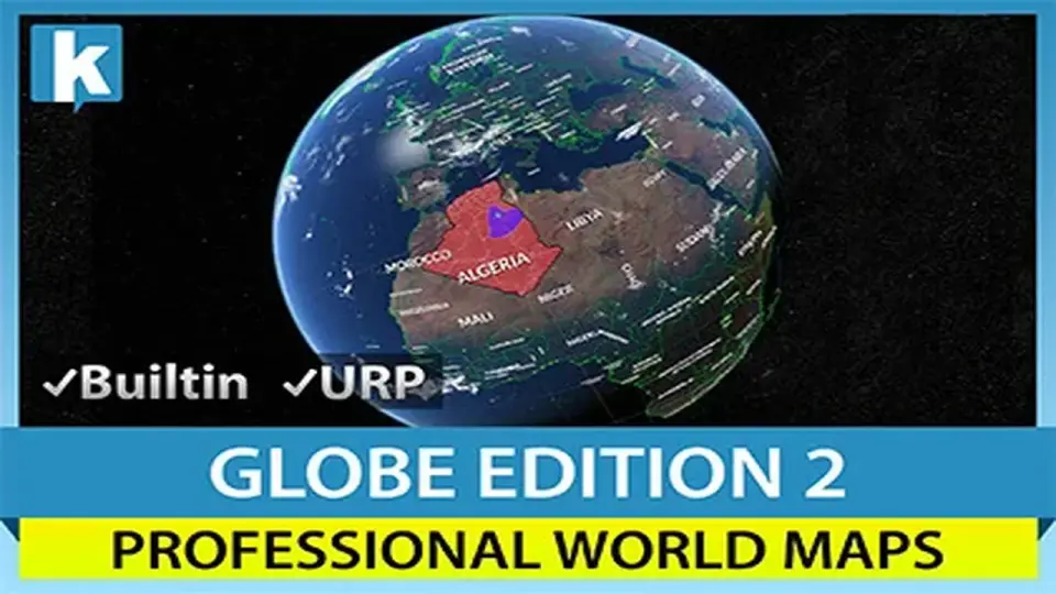
World Map Globe Edition 2 is designed as an interactive 3D world map prefab that developers can integrate into Unity scenes with minimal setup. At its core, the tool procedurally draws the frontiers of 240 countries and 4,112 provinces and states. It also includes the locations of 7,144 of the world’s most populated cities. Because this data is stored locally within the asset, the map functions entirely offline without requiring an active internet connection to render borders or place urban centers.
The underlying database provides more than just visual markers. It includes continent, country, city, and province names, as well as metadata such as metropolitan population counts and international coding standards like FIPS 10-4 and ISO A2, A3, and N3 codes. This data structure allows for complex relationships where countries can contain multiple distinct regions and provinces, all accessible through the included API.
Visual Fidelity and Planetary Shaders
The asset offers 19 distinct Earth styles, utilizing custom planetary shaders to handle visual effects like relief, atmosphere, clouds, and city lights. These shaders are built to be compatible with mobile hardware while maintaining high-resolution options for desktop projects, with textures ranging from 2K to 16K. The system also includes a real Milky Way skybox and a moon model to complete the celestial environment.
For developers needing specific visual outputs, the "Bake Earth texture" command allows for the production of custom textures where specific areas have been colorized directly into the map. Visual synchronization features further enhance the realism by automatically aligning the map with real-time daylight cycles, ensuring the day/night transition matches the actual time.
Interaction, Grids, and Pathfinding
Interactivity is integrated into the map’s regions and administrative boundaries. As a user moves the cursor over the globe, countries, provinces, and states highlight automatically. Beyond simple selection, developers can colorize or texture individual countries and continents or apply specific textures on a per-country basis. For tactical or data-heavy applications, the asset features a fully interactive Hexagonal Grid. This grid supports pathfinding, allowing developers to select, colorize, and texture individual hex cells for strategy-based mechanics.
Navigation and annotation are handled through markers and PINs. These can be represented as 2D sprites or 3D objects that respond to user input. The tool also supports the drawing and animation of circles and lines across the globe's surface, which is particularly useful for visualizing aerial trajectories or movement between two points. Additionally, "Mount Points" allow for the creation of custom strategic locations within the Editor, making it easier to navigate or position objects at specific coordinates.
Tile Systems and External Integration
While the asset is capable of full offline operation, it includes a single-click integration system for various Online Map Tile Systems. This supports services such as OpenStreetMap, MapBox, Google Maps, Stadia Maps, and Xweather, among others. The progressive rendering system ensures that visual quality remains high as the user zooms in on specific regions. To bridge the gap between online and offline needs, a tile downloader assistant is included to facilitate offline tile support.
The system also incorporates GPS support, which can automatically track the position of a device on the map. For labeling, the asset uses TextMesh Pro and features automatic alignment and placement options to ensure country labels remain legible and correctly positioned regardless of the camera's orientation.
Specialized View Modes and VR Support
World Map Globe Edition 2 is built with VR development in mind, offering two distinct camera modes. A unique "Inverted view" mode is included specifically for immersive VR experiences, allowing the user to be positioned at the center of the world looking outward. This provides an alternative perspective to the traditional external orbital view. Whether used for desktop applications, mobile tools, or virtual reality projects, the asset provides a flexible framework for geographic visualization without the need for external data dependencies.
 GUI
GUI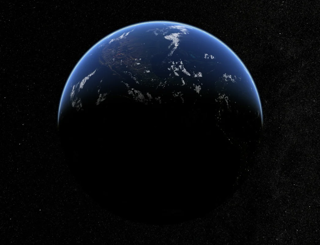
 GUI
GUI GUI
GUI GUI
GUI